Op-Ed: Why California wasn’t prepared for the atmospheric rivers

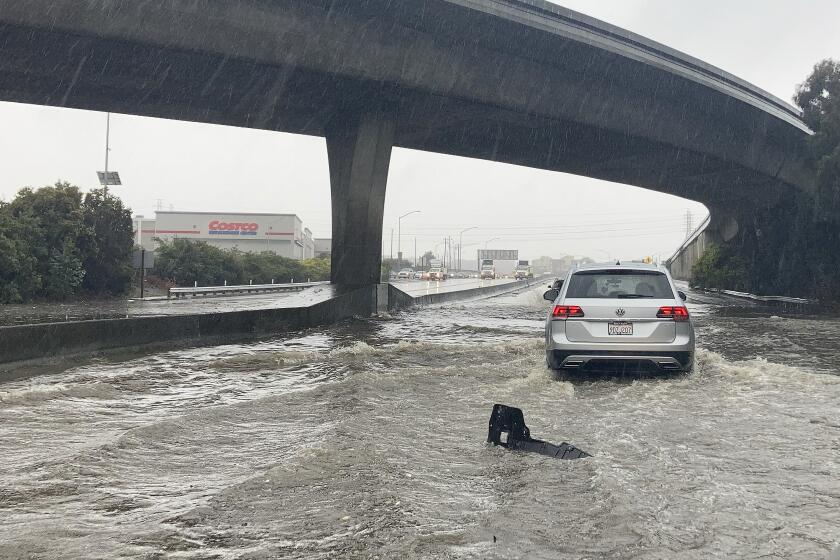
Los Angeles International Airport recorded 5 inches of rain during the entire 2020-2021 rainfall season. In 2023, that much rain fell in the first two weeks of January. This boom-and-bust cycle of precipitation is normal — climate scientists call it “internal variability” and it is described in the biblical story of Joseph, who predicted seven years of plenty followed by seven years of famine. But that doesn’t make it any less destructive. In the Bible, Joseph’s divination helped the Egyptians plan for the lean years by stockpiling grain, and in the modern world we rely upon climate models to help engineers and water managers prepare for both drought and deluge.
When it comes to dry spells, these models are fairly reliable: Researchers have been predicting longer and drier droughts in the Southwest for more than a decade. The downpours, however, have proved much more challenging to forecast; as recently as mid-November, the National Oceanic and Atmospheric Administration’s three-month outlook still predicted below-average winter precipitation in Southern California.
Why is it so much more difficult for climate models to accurately predict rain? To begin with, there’s what’s known as the “drizzle problem.” Climate models have been calibrated to produce roughly the right total amount of rain, but they do so by forecasting too much light rain and almost no heavy rain. In addition, atmospheric rivers tend to be long, thin bands of wet air (hence the comparison to actual rivers), which is exactly the sort of shape that models struggle with the most.
When California gets storms like this, water managers around the state are probably shaking their head and asking, why can’t we hold on to more of that water?
Climate models also have inherent biases — ways in which we can observe that their predictions do not match observations. These are particularly pronounced when it comes to the high-level winds that guide the track of the atmospheric river, leading to incorrect trajectories. Finally, recent research has suggested links between atmospheric rivers and two oscillations in the atmosphere that carry energy and moisture to the West Coast from as far away as the Indian Ocean and as high as the stratosphere. However, today’s climate models have inaccurate or even nonexistent versions of these oscillations, meaning that an important cause of atmospheric rivers is completely missing from our simulations.
Of course, there are many things that climate models get right — over the last 50 years they have proved to be overwhelmingly accurate at predicting global-scale phenomena such as increasing temperatures, longer droughts and melting ice sheets. But the fact that they are so good at these sorts of forecasts means that less attention gets paid to equally important local questions that remain unanswered such as: Should we prepare for increased flooding along the Sacramento River? Will we continue to see elevated tree mortality in Sequoia National Forest? How much earlier in the year will Sierra Nevada snowpack be depleted?
Just as climate models have inherent biases, so too do policymakers — it is easier to prepare for a predictable threat than an unpredictable one, and so money and resources gravitate toward the problems that we know are coming.
For decades, El Niño seemed synonymous with wet winters for Southern California, while La Niña was a heralder of drought. But the would-be model didn’t hold up this winter.
The primary cause for these gaps in knowledge at the local level is something called coarse model resolution. Global climate models divide the Earth’s atmosphere into grid boxes that measure about 60 miles across, meaning that the model predicts the same climate on top of Mt. Baldy as it does in Joshua Tree. This kind of coarse modeling results in a cascade of problems. The model cannot capture individual mountains, so it flattens out peaks and valleys into a series of plateaus, making a mess of wind speed predictions. Pollution plumes that should be narrow are instead dispersed too quickly across large areas, and it is much harder to predict precipitation when your grid box is much larger than the size of a cloud.
These problems can be reduced by embedding a smaller, finer model within a large coarse one, enabling much more accurate local forecasts. One reason this approach has not been more widely used is the cost; adding local models is more computationally expensive and need to be repeated for each area of interest.
In September, the Biden administration released the PREPARE action plan to spur climate resilience, which includes a pledge to “work with Congress to provide $3 billion in adaptation finance annually.” If this funding does come through, it is important that some of it be set aside for boosting the field of regional modeling so that we can better allocate the rest of the package. That said, producing more local models is not a silver bullet, mostly because there really isn’t such a thing as a “regional atmosphere.” For example, when the model smooths out the Rocky Mountains, that affects its predictions of the climate in Denver as well as in places as far away as London.
As climate change affects the atmosphere and weather patterns, all of humanity is now witness to a global science experiment, one that even our best predictions will never fully capture. These recent atmospheric rivers serve as a reminder that models are not infallible and that moving forward our society and infrastructure will be challenged in ways we haven’t yet anticipated.
Ned Kleiner is a PhD candidate at Harvard studying atmospheric science.
More to Read
A cure for the common opinion
Get thought-provoking perspectives with our weekly newsletter.
You may occasionally receive promotional content from the Los Angeles Times.


