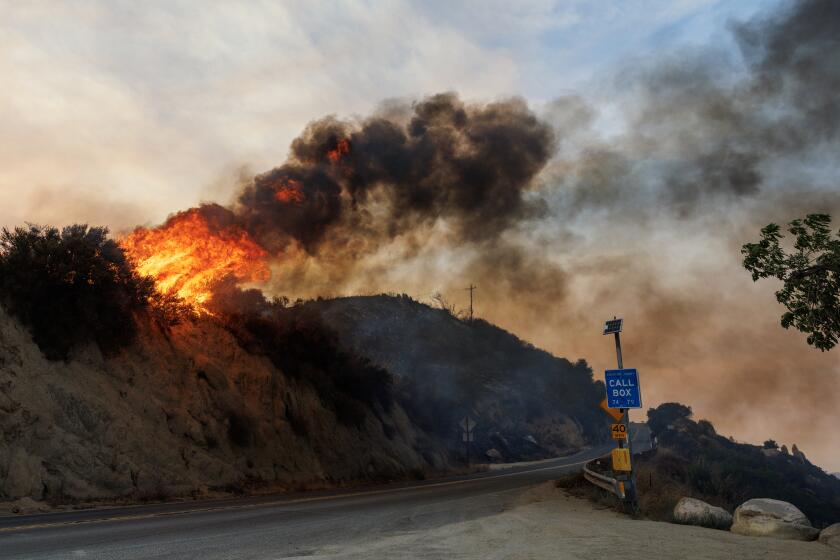
Maps show the mudslide and debris flow threat from the Thomas fire
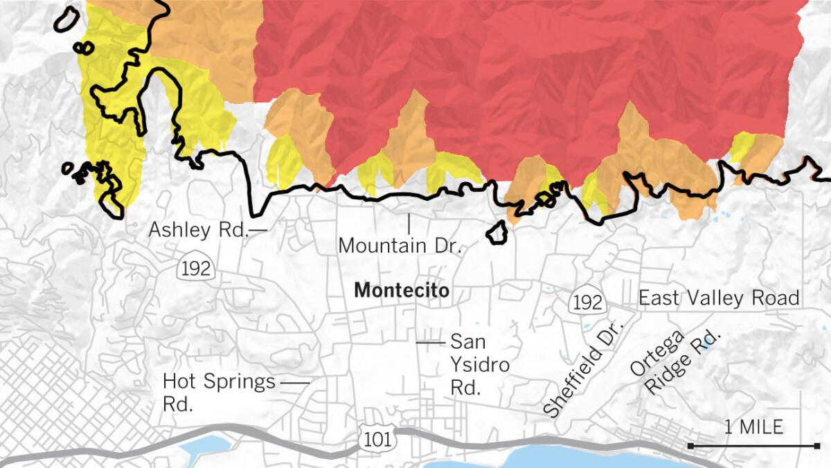
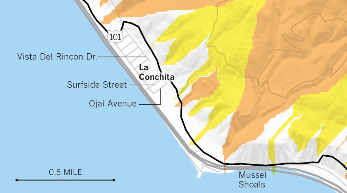
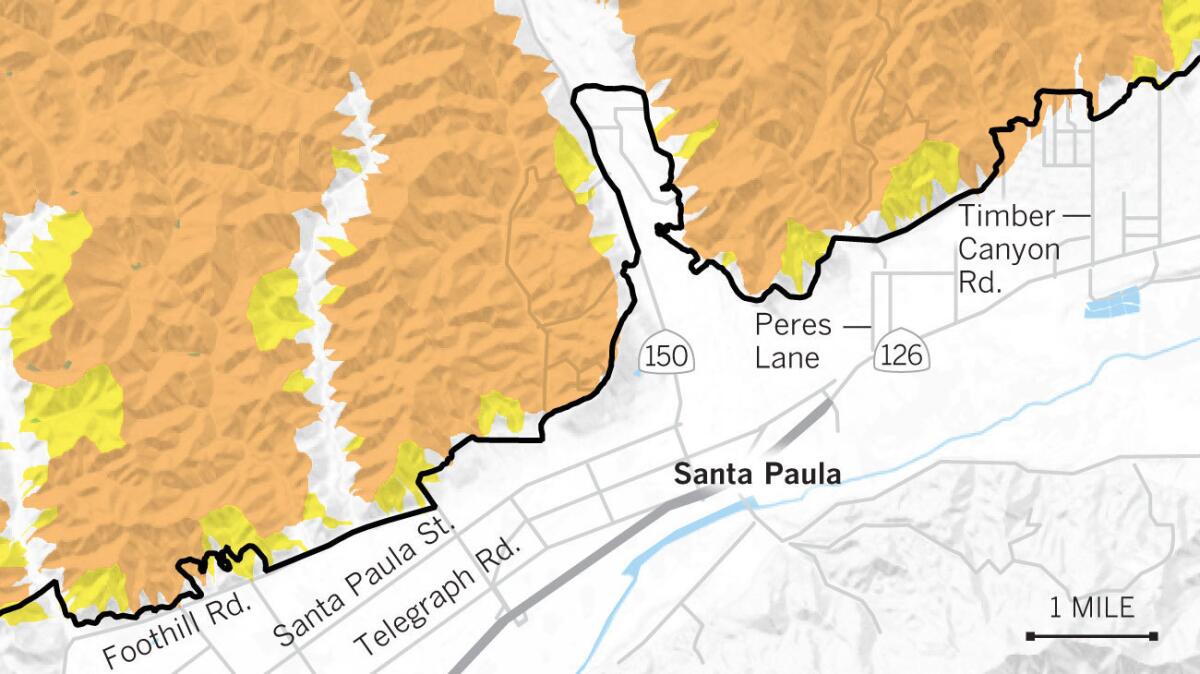
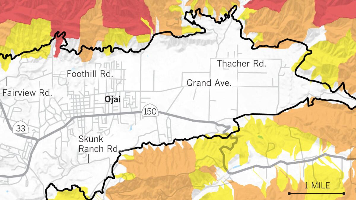
The U.S. Geological Survey studied the Thomas fire’s burn area to determine its vulnerability to flash floods, mudslides and debris flows.
The Thomas fire is California’s largest wildfire on record, burning more than 280,000 acres during its destructive march across Ventura and Santa Barbara counties.
Montecito
La Conchita
Santa Paula
Ojai
Evacuations announced
Authorities have ordered evacuations of Santa Barbara County neighborhoods that sit below areas recently burned by wildfires.
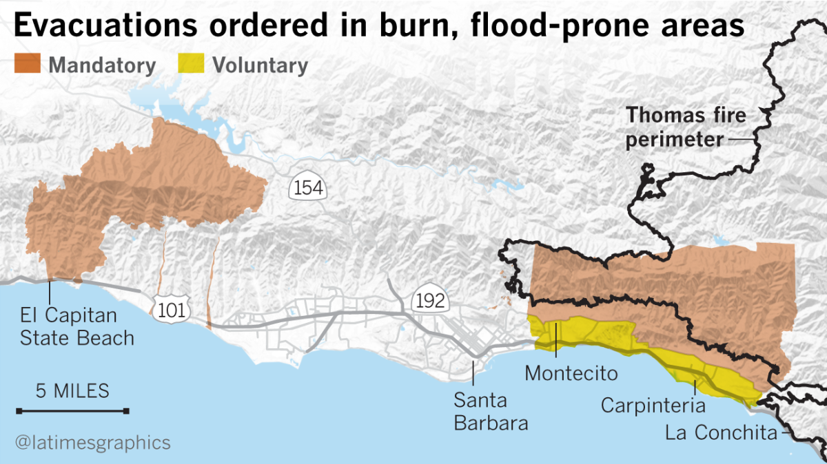
Sources: Santa Barbara county, U.S. Geological Survey Landslide Hazards Program, California Department of Forestry and Fire Protection. The likelihood of a debris flow is based on a peak 15-minute rainfall intensity of 24 millimeters per hour. Scientists used burn severity, soil properties, rainfall data and a number of other factors for their estimation.
Sign up for Essential California
The most important California stories and recommendations in your inbox every morning.
You may occasionally receive promotional content from the Los Angeles Times.


