California maps will point to tsunami danger zones
California officials on Friday announced that they were beginning to draw tsunami flood maps in Huntington Beach, Crescent City and other communities that local cities could use to regulate development in areas along the coast at risk during a large tsunami.
The California Geological Survey made the announcement Friday in advance of the 50th anniversary of the deadliest tsunami that has hit modern California. Fifty years ago next Thursday, a tsunami triggered by a 9.2 earthquake in Alaska killed 13 people in California alone.
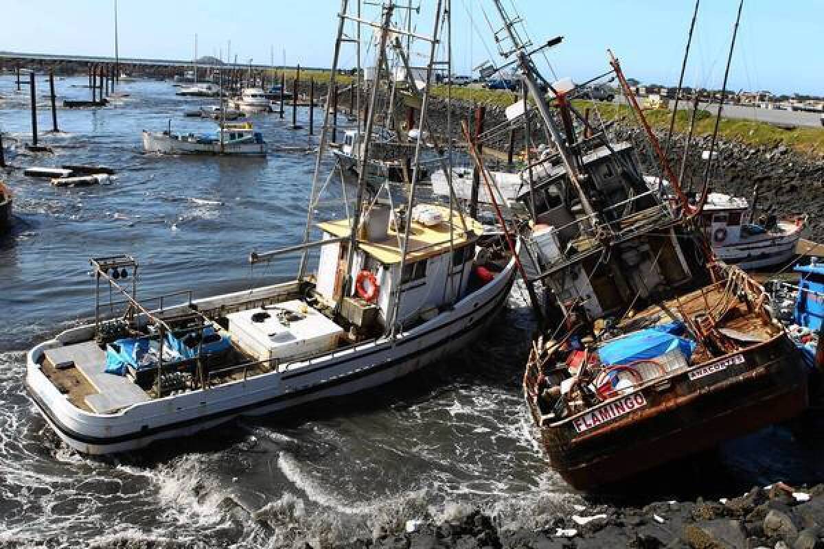
The new mapping efforts come after harbor officials, boaters and marina residents had no emergency plans in place when a February 2010 earthquake in Chile produced a tsunami that struck California’s coast and caused millions of dollars in damage to harbors.
“Harbor masters and emergency managers were really caught off guard by this,” said Rick Wilson, head of the California Geological Survey’s tsunami program. “At this point, we started looking to produce products that might help them for planning purposes and also knowing if, and when, they needed to take ships off-shore.”
The 2010 tsunami and the tsunami that struck California after the 2011 earthquake in Japan has given state officials, for the first time, substantial data and information to develop plans on how to better act when the next devastating wave hits. This data is being used to better pinpoint what areas face a risk from tsunamis.
“Before those two events, we really didn’t have any detailed information about tsunamis along our coast,” Wilson said. “But because those two events occurred, we were able to have staff go out and collect the data -- it was priceless, really.”
Huntington Beach and Crescent City are the pilot cities for these land-use planning maps. In the past, maps like these have been mainly published for research or informational purposes, but officials are now working to create maps that would help local officials decide where to build in tsunami flood zones, and to consider any additional safety designs.
Any changes in development or zoning could come from local cities or state legislature, not the California Geological Survey.
Wilson, who is also working with the Federal Emergency Management Agency and California’s Office of Emergency Services, said state officials were also developing tsunami response “playbooks” for 130 coastal communities, harbors and marinas. For each community, officials will map out worst-case scenarios, identify specific local hazards, set up potential emergency plans and spell out how far from shore a boat must be during a large tsunami.
State officials have completed studies in five areas -- San Diego, the ports in L.A. and Long Beach, Ventura, Santa Cruz and Crescent City – and plan to make these playbooks available online and complete the rest of the 130 maps by the end of the year.
About 100 tsunamis have been observed in California since 1800, 13 of which were large enough to cause damage across the state, Wilson said.
“Tsunamis have done a surprising amount of damage in California over the years,” said state geologist John Parrish. “But because they are relatively rare occurrences, the approach has been reactive rather than proactive. We’re trying to change that.”
California has been preparing for decades to deal with major earthquakes, but tsunamis have been an under-scrutinized hazard for years -- particularly before the 2004 Sumatra tsunami and the 2011 Japan tsunami brought attention to the hazard.
FULL COVERAGE: Earthquake risks in California
The most extensive examination of what a tsunami would do to California’s coastline was published last fall by the U.S. Geological Survey. The simulation identified several communities, such as Marina del Rey and the ports of Los Angeles and Long Beach, that are particularly vulnerable to flooding because of their low elevation and lack of protection from waves.
The tsunami, simulating a temblor similar to the devastating 1964 quake off the Alaska coast, would cause major flooding in Long Beach and parts of Orange County and force 750,000 people to evacuate coastal areas in just a few hours, according to the study.
While waves would be larger in Northern California -- between 10 and 23 feet -- the damage could be greater in Southern California because the region has more coastal development and fewer coastal cliffs.
Tsunami waves of 3 to 10 feet could submerge blocks of Long Beach south of Ocean Boulevard, including the Aquarium of the Pacific and the Long Beach Convention Center as well as the Shoreline Village and Pike shopping centers. Those same-sized waves could cause flooding around the affluent communities of Newport Bay and Huntington Harbour as well.
Officials across the state are preparing educational community events next week for Tsunami Preparedness Week. More information on tsunami hazard areas in California can be found at www.tsunami.ca.gov and https://myhazards.calema.ca.gov.
This post was updated at 9:49 p.m.
ALSO:
Tsunami study finds Southern California at risk
A potent threat of major earthquake off California’s northern coast
FULL COVERAGE: Earthquake risks in California
Twitter: @RosannaXia | @ronlin
More to Read
Sign up for Essential California
The most important California stories and recommendations in your inbox every morning.
You may occasionally receive promotional content from the Los Angeles Times.

