California’s about to get its first big atmospheric river of the season. Here’s where it’s going

The strongest atmospheric river to hit California in months is expected to dump rain and snow across the northern half of the state this week — also bringing high winds and possible flooding — before eventually making its way south, forecasters say.
“This is going to be the first major storm of the season,” said Dial Hoang, a National Weather Service meteorologist in Monterey. The low pressure system off the Pacific Northwest coast driving this storm will begin rapidly intensifying Tuesday — reaching the threshold of a bomb cyclone — which will drastically increase its moisture and strength.
Parts of northwest California will be under flood and high wind watches starting Tuesday, when persistent rain is expected to begin, dropping 4 to 8 inches over several days. Some ridgetops could see gusts up to 75 mph.
“A powerful storm system will bring heavy mountain snowfall, rain and high winds to the Pacific Northwest and Northern California through midweek,” the National Weather Service Weather Prediction Center warned. “Numerous flash floods, hazardous travel, power outages and tree damage can be expected as the storm reaches max intensity” on Wednesday.
But after its initial peak, the system is expected to linger into the weekend, with a second wave of rainfall extending farther south across most of the San Francisco Bay Area, down into the Central Coast and possibly reaching parts of Southern California.
The North Bay is forecast to see 3 to 7 inches of rain from Wednesday through Sunday, with some areas seeing up to 11 inches, according to the National Weather Service’s forecast discussion. Officials are hopeful the region will see only minor flooding, as few areas have seen any real rainfall this season, so soils should be able to absorb significant precipitation.
But, some areas of the North Bay “will likely become saturated very quickly,” Dalton Behringer, a National Weather Service meterologist, wrote in the daily forecast. “Even if we don’t see too many flooding impacts Wednesday, I wouldn’t be surprised if flooding gets worse Friday with the second wave, even though less rain is expected during that time.”
Some light rain could reach Southern California by the weekend, but it probably won’t be enough to eliminate any wildfire threat through the end of the year.
“It’s not going be what Northern California will be, but any bit helps,” said Bryan Lewis, a National Weather Service meteorologist in Oxnard. “It’s probably not enough to get us completely out of the clear yet [for fire concerns].”
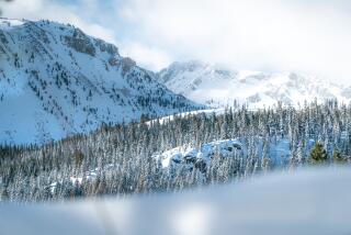
A winter storm watch has been issued for the northern Sierra Nevada and other Northern California mountains above 3,500 feet, where 4 to 15 inches of snow is possible Tuesday and Wednesday.
This storm is kicking off what appears to be a stretch of wet weather across the entire state, with above-average precipitation expected through at least Thanksgiving, according to the National Weather Service’s Climate Prediction Center.
More to Read
Sign up for Essential California
The most important California stories and recommendations in your inbox every morning.
You may occasionally receive promotional content from the Los Angeles Times.


