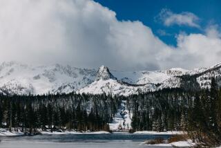
March storms weren’t enough to boost California’s snowpack, officials say

A series of late winter storms that dampened the Southland in March were not enough to boost California’s snowpack, despite high hopes among water managers.
The snowpack, measured on Wednesday at the California Department of Water Resources’ Phillips station, was 43.5 inches, about 66% of average for the time of year at the location. If all the snow were to melt at once it would amount to about 16.5 inches of water, said Sean de Guzman, chief of the agency’s snow surveys and water supply forecasting section.
Measurements from the 130 electronic snow sensors scattered throughout the state indicate a water equivalent is 15.2 inches, or 53% of the April average, de Guzman said.
The lackluster snowpack comes as the state continues to experience extreme variability in weather as a result of climate change, experts say. In a single year, California went from having the fifth-deepest snowpack ever recorded last year to one of the 10 shallowest.
That 2019 snowpack was boosted by a series of atmospheric rivers paired with cold fronts that pounded the state late in the winter. That has given the state some cushion this year, officials said.
“Over the last decade, California’s snowpack has been alternating between extremely wet and extremely dry,” de Guzman said in a statement. “In the past 10 years, we’ve seen three of our smallest snowpacks on record, but we’ve also seen three of our largest snowpacks on record.”
The results of the fourth seasonal measurement, an important indicator of the state’s water supply, was announced via video without much fanfare. The coronavirus pandemic and social distancing orders prevented surveyors and the usual group of reporters from gathering at the station above Lake Tahoe, as they typically do, to take the measurement.
The snow season customarily begins in December and ends on April 1, when the snowpack is normally at its highest. However, surveyors will continue to measure the pack as long as there’s snow on the ground, often through May. How much snow falls during this period is critical to California’s annual water outlook and is watched closely by state water managers.
The snowpack provides about 30% of the annual freshwater supply for the state. Its spring and summer runoff feeds rivers and reservoirs, and part of it is distributed to water agencies for farm irrigation, landscaping and urban drinking supplies.
Wednesday’s measurements, though better than February’s, “still underscore the need for widespread, wise use of our water supplies,” water resources Director Karla Nemeth said in a statement. “California’s climate continues to show extreme unpredictability, and February’s record dryness is a clear example of the extremes associated with climate change.”
The snowpack’s measurement in January was also below average for the season.
However, there may still be hope for this year. A pair of Pacific storms moving in over the weekend are expected to bring fresh snow to the Sierra Nevada, according to the National Weather Service.
Forecasters predict the storms could drop several inches of powder and possibly cause travel disruptions.
Despite the snowy forecast, California’s dry winter has already pushed much of the state into drought conditions, according to a map released by the U.S. Drought Monitor on Thursday.
About 75% of the state is considered to be experiencing abnormally dry conditions. Another 43% is in a moderate drought and a small sliver of the state in Northern California is considered to be in a severe drought, the map shows.
The Associated Press contributed to this report
More to Read
Sign up for Essential California
The most important California stories and recommendations in your inbox every morning.
You may occasionally receive promotional content from the Los Angeles Times.


