Rainfall in February looks bleak. Is California heading for another drought?
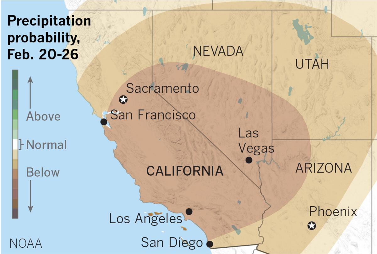
Swaths of Southern California, including downtown Los Angeles, could be heading toward one of the driest combined starts to a year on record if the Golden State doesn’t start getting some rain, the National Weather Service said Thursday.
While precipitation in November and December provided a solid start to winter across the state, a persistent high-pressure ridge hovering over the eastern Pacific Ocean has kept wet weather at bay for much of January and early February, said David Sweet, a meteorologist with the National Weather Service in Oxnard.
“It’s been successful in diverting all of the Pacific storms into the Pacific Northwest up near Seattle,” Sweet said. “Overall for January and February, we’ve been far below normal in terms of rainfall.”
Downtown Los Angeles received 0.32 inches of rain in January. So far in February, which is typically the wettest month of the year, the area has received just a trace of precipitation. Typically, downtown Los Angeles receives 6.92 inches of rain in January and February, according to the weather service.
The total seasonal rainfall so far in downtown is also more than an inch below normal, coming in at just 7.28 inches, data show.
“By this time in the season last year, downtown Los Angeles had 13.29 inches of rain, a full six inches more than we have this year,” Sweet said. “This gives you a good contrast between the two seasons.”
And it doesn’t appear to be getting wetter anytime soon.
Long-term models don’t show any significant rain in Southern California for at least the next two weeks and it’s possible that parts of the northern section of the state could go completely dry for the rest of February, climatologists say.
About 46% of the state, including Santa Barbara and Ventura counties and much of Los Angeles County, is already in abnormally dry conditions because of the lack of precipitation this year. About 9.5% of the state, centered across the San Joaquin Valley, is already considered to be in moderate drought conditions, according to a map released by the U.S. Drought Monitor on Thursday.
The lack of rain has also taken its toll on the Sierra Nevada snowpack, a key source of the state’s water supply. On Thursday, the statewide snowpack measured 59% of average for the time of year.
The snow season typically begins in December and ends on the first day of April, when the snowpack is normally at its highest. How much snow falls during this period is critical to California’s annual water outlook and is watched closely by state water managers.
The snowpack provides about 30% of the annual freshwater supply for the state. Its spring and summer runoff feeds rivers and reservoirs, and part of it is distributed to water agencies for farm irrigation, landscaping and urban drinking supplies.
The good news, officials say, is that the state’s reservoirs, including Folsom Lake and Shasta Lake, are near or above their averages for this time of year, thanks in part to solid rainfall last winter.
Despite the lackluster winter weather, experts say it’s too early to say whether the state is headed for another massive and persistent drought. Historically in California, it takes two years of significantly below-normal rainfall to create a drought, said Daniel Swain, a climate scientist with UCLA and the National Center for Atmospheric Research.
“The likelihood is that this winter will end up being dry,” Swain said. “If we have another dry winter, we would be in a significant drought, but we won’t quite be there this year.”
Last year, the Drought Monitor map showed no areas suffering from prolonged drought for the first time since 2011. The last drought, which was declared over in 2017, led to restrictions on outdoor irrigation and other users in urban areas and resulted in cutbacks in water delivery for agricultural uses. Millions of trees across California also died during the drought, which contributed to devastating wildfires.
Bill Patzert, a weather expert and former climatologist with the Jet Propulsion Laboratory, contends California never really fully emerged from the last drought.
“I think of droughts in the long term, not year to year. Droughts tend to be long, they tend to be large and they wax and wane,” Patzert said. “The other thing is they fool you. You think you’re out and they pull you back in.”
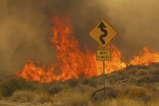
Even if the state isn’t looking down the barrel of an outright drought, a dry winter does bring other consequences, including increased wildfire risks as the state’s forests dry out.
And if Southern California receives a burst of rain in March and April, those conditions may be too late to keep grasses from curing earlier than normal. Late rains also allow seasonal grasses and brush to grow more rapidly, providing more fuel for wildland fires.
A report from the National Interagency Fire Center, released earlier this month, predicted large fire potential to climb to above normal levels for Southern California due to an early onset of springtime grassfire season.
“The worst combination for fires is a relatively dry winter followed by a burst of wet conditions late winter and spring,” Swain said. “The extra growth of the grass and a really dry forest can be a bad combination.”
More to Read
Sign up for Essential California
The most important California stories and recommendations in your inbox every morning.
You may occasionally receive promotional content from the Los Angeles Times.
