Strong snowpack is good news for California’s water supply as storms hit the mark

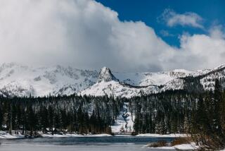
After a slow start to California’s wet winter season, a series of storms that hammered the state at the tail end of 2019 dumped enough snow on the Sierra Nevada to kick off the new year with a solid snowpack.
That is good news for the state’s water supply, which has been taxed until recently by drought conditions. The snowpack provides about 30% of the annual fresh water supply for the state. Its spring and summer runoff feeds rivers and reservoirs and eventually is distributed to various water agencies for farm irrigation, landscaping and urban drinking supplies.
A recent survey found that only 3.6% of the state was abnormally dry, a major improvement from the drought years.
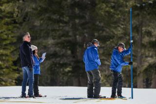
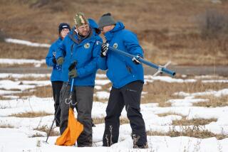
Surveyors with the California Department of Water Resources trudged through a snow-covered field Thursday at the department’s Phillips station — fresh powder crunching beneath their snowshoes —and plunged a hollow pole into the snowpack for the first monthly measurement that serves as an important marker for the state’s water supply.
The result — 33.5 inches deep — amounted to a promising start, officials said. That number is 97% of average for the time of year and 44% of the April 1 average in that location. If all the snow were to melt at once it would amount to about 11 inches of water, said Sean de Guzman, chief of the agency’s snow surveys and water supply forecasting section.
“It’s still too early to predict what the remainder of the year will bring in terms of snowpack,” he said. “Climate change is altering the balance of rain and snow in California. That is why it is important to maintain our measurements of the snowpack to document the change, in addition to having critical information to forecast spring runoff.”
The snow season typically begins in December and ends on the first day of April, when the snowpack is normally at its highest. However, surveyors will continue to measure the frozen reservoir as long as there’s powder on the ground, often through May. How much snow falls during this period is critical to California’s annual water outlook and is watched closely by state water managers.
Hours before official measurements were taken Thursday morning, agency spokesman Chris Orrock looked out across the snowy field at the Phillips station and remarked on the promising size of the snowy blanket, thanks to late November and early December storms.
“We’re cautiously optimistic,” Orrock said. “We had a really good December, probably the best December snowpack since 2010, but just because it’s a good start doesn’t mean we’re going to have a good season.”
The Phillips station — a large field 30 miles west of Lake Tahoe — was grassy and dry when surveyors attempted to measure the snowpack in January 2018. In 2019, conditions were significantly better, with the January snowpack measuring 25.5 inches and 80% of average for the date.
That 2019 snowpack — which picked up later in the winter, boosted by a series of atmospheric rivers paired with cold fronts that pounded the state — was ultimately the fifth best in recorded history. In early June, the snow blanketing the vast mountain range was 201% of average, making it the largest June snowpack in nearly a decade, thanks to a wave of late spring rainstorms.
Some sections of the vast Sierra Nevada range have received more snow than others from recent storms.
The snowpack in the southern section of the range is 104% of average for the date, while the central and northern sections are 90% and 77% of average, respectively. However, those numbers could change with the help of a few solid winter storms in the next few months, said climatologist Michael Anderson.
“A single atmospheric river storm can bring a significant amount of water in a short period of time and change things considerably,” he said.
Experts say it’s still too early to predict how much rain the state will receive this winter. A wildfire outlook report issued Wednesday by the Southern California Geographic Coordination Center in Riverside indicates that long-range models are edging toward the likelihood of drier than average weather for the rest of the winter, with some of the greater deficits occurring in January and February.
“The majority of long-range models had been consistent in showing well below normal precipitation this winter across California and much of the Southwest,” the report states.
Despite the lackluster outlook, the state’s water supply appears to be in good shape so far.
As of Thursday, most of the state’s largest reservoirs were near or just above historical averages for January. Lake Shasta, the state’s largest reservoir, is 73% full, or 117% of normal for the time of year. Lake Oroville in Butte County is 59% full, or 96% of normal, while the Don Pedro Reservoir in Tuolumne County is 80% full, or 121% of its historical average.
More to Read
Sign up for Essential California
The most important California stories and recommendations in your inbox every morning.
You may occasionally receive promotional content from the Los Angeles Times.


