Late Winter Storm Gives Southland a Picture-Perfect Day
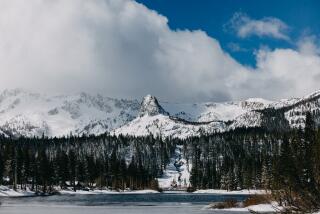
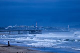
The overnight departure of a storm that cleared the air and blanketed the mountains with snow left Southern California with one of those brisk, sparkling, sun-washed days on Monday that chambers of commerce love to boast about.
Temperatures were on the cool side, hovering in the 60s throughout the Los Angeles Basin, but gusty breezes cleared away the clouds, with visibility of up to 120 miles.
Residents of hillside communities were treated to spectacular views of the offshore islands, ringed by white-capped waves. Those who live along the coast saw a panorama of snow-clad peaks that ranged 150 miles from Mt. Pinos in Ventura County to Mt. San Jacinto in Riverside County.
Some of the heaviest snow fell Sunday night near Gorman in the Tehachapi Mountains north of Los Angeles, enough to force the closure of Interstate 5, the state’s principal north-south highway, at 10 p.m.
Stranded motorists scrambled for motel rooms or waited the chilly night out in their cars.
By 2 a.m. Monday, the Castaic Inn and Motel had run out of rooms. Dalia Corona, one of the motel’s employees, said there were as many people sleeping in vehicles scattered about the parking lot as there were in the rooms.
Roseann Duke, manager of a McDonald’s restaurant in Castaic, arrived at work at 4 a.m. to find streams of vehicles snarled in the effort to find alternate routes through the mountains.
“It was nuts,” she said. “It was so crowded you couldn’t park here.”
Plows finally cleared the snow from I-5, and the California Highway Patrol reopened the route about 8 a.m.
Corona said everyone tried to leave at once.
“I had to check people out, answer their questions, give them coffee or orange juice and answer the phones,” she said.
To the north, blizzard conditions forced the closure of Interstate 80 in the High Sierra for several hours, and snow levels dropped as low as 900 feet in the hills above Oakland.
Hail the size of grapes fell in Solano County. Funnel clouds were reported near Vacaville and Antioch.
As has been so often the case this winter, the rainfall in Southern California was generally light. Totals from the storm included 0.51 of an inch in Altadena, 0.48 in Malibu, 0.31 in San Diego, 0.24 in Riverside, 0.22 at John Wayne Airport in Orange County and 0.21 at Santa Monica Airport.
The National Weather Service said 0.11 fell on downtown Los Angeles, raising the total for the season, which runs from July 1 through June 30, to 4.21 inches. That’s less than one-third the normal total for the date of 12.88 inches.
Forecasters said skies should remain mostly clear, with gradually warming temperatures, through Thursday. They added that there’s a chance of more showers by late Friday or early Saturday, “but it will certainly be nothing to write home about.”
More to Read
Sign up for Essential California
The most important California stories and recommendations in your inbox every morning.
You may occasionally receive promotional content from the Los Angeles Times.


