Using Bits, Not Bricks, Virtual L.A. Sculpts City
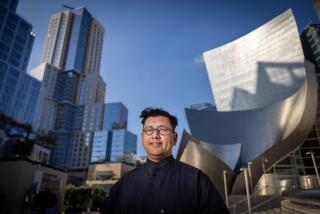
Bill Jepson drives through a canyon of skyscrapers under a partly cloudy sky, passing the shiny black tubular towers of the landmark Bonaventure Hotel, concrete office buildings, neon-lit shops and posh apartments.
But the landscape disappears when he wanders south of 9th Street. No buildings. No roads. No people.
The void doesn’t worry Jepson--his digital construction workers just haven’t finished that neighborhood on the powerful machines in their computer lab.
Using bits instead of bricks, the Virtual L.A. team is slowly rebuilding the City of Angels to within inches of accuracy. Once an area is finished, it can be walked, driven or flown through just as freely and realistically as in the real world.
The availability of high-powered databases and software has led to projects like Virtual L.A. in several cities, including Berlin, Philadelphia and San Francisco. They could revolutionize urban planning, emergency preparedness and tourism, developers say.
“It’s really an information system, not just a visualization system,” said Jepson, leader of the Urban Simulation Laboratory and Virtual L.A. at UCLA. “We use the digital metaphor of the 3D world around us as a way of locating information.”
Virtual L.A. sounds like a video game or flight simulator, but it’s much more detailed, realistic and interactive. Layers of information from floor plans to restaurant menus to Web pages can be linked to any building or other objects inside the massive database.
Though only 20 of Los Angeles’ 465 square miles have been reconstructed, at a cost of anywhere from $4,000 to $12,000 a block, the technology has already attracted the attention of firefighters, police departments, architects and urban planners.
“The opportunity is the integration of all the data and knowledge about a city,” said Bernard Pailthorpe, director of scientific visualization at the San Diego Supercomputer Center. More information can lead to better decision-making, he added.
In Santa Monica, residents who live near a UCLA hospital project were worried that a large parking garage planned for their neighborhood would become an eyesore. Virtual L.A. showed them exactly how it would look, and trees and shrubs were added to alleviate concerns.
“We came up with a better solution and short-circuited the problem by several months,” Jepson said. “Neighbors could look at it and understand exactly what it is.”
Emergency planners, firefighters and police want to use the technology to create realistic training simulators modeled from real terrain. Or they can test plans to respond to real-time disaster without risking lives.
“With a tool like this, we can sit in one location and do modeling on how we’re going to respond to a particular situation,” said Ellis Stanley, emergency manager for Los Angeles. It shows “your exposures, what you can expect in this building, the terrain around it, the fire hydrants.”
Tourists also could navigate a city before setting foot in it. Inside a car, a computer could superimpose a route onto a screen just as a driver travels through the area.
The Virtual L.A. team has been adding streets, freeways and other details to the system for seven years. Within the next decade, all of Southern California, from Santa Barbara to San Diego, should be modeled.
“We don’t know if our clients want to turn right or turn left, fly up in the air, look down or whatever,” Jepson said. “We have to build everything.”
It can be a tedious process. Student assistants first draw simple white shapes and then electronically paste pictures on them. The computer alters the perspective as a location is viewed from different angles.
The challenge of the project is not only re-creating the city but finding a way to store and dish out the data. And although today’s home computers are becoming stronger and faster, the machines needed to process such information won’t hit store shelves for a few more years.
Virtual L.A. will eventually become accessible via the Internet. The National Science Foundation is funding research into ways of efficiently moving the information from database to networked computers.
Layers of information then could be added by anyone, from the architects to property owners to the people who live and work in the buildings.
“What we’re trying to do here is provide an overall structure so it all fits together and works together,” said UCLA computer science professor Richard Muntz, who is developing the Virtual L.A. database.
More to Read
Sign up for Essential California
The most important California stories and recommendations in your inbox every morning.
You may occasionally receive promotional content from the Los Angeles Times.


