El Nino: Problem Child
The weather phenomenon called El Nino has forecasters warning Southern Californians to prepare for one of the worst winters in recent history. By closely monitoring the South Pacific and tracking weather conditions, scientists can predict the effects of El Nino.
Defining El Nino?
El Nino--Spanish for “the child”--refers to an ocean current in the South Pacific, so named because it appears in Peru around Christmas.
Normal Year:
Trade winds normally extend nearly all the way across the equatorial Pacific. Sea surface temperatures are cooler overall as winds cause cold water to move from the deep ocean to the surface, a process called upwelling. Heavy rainfall is confined to the warm waters surrounding Indonesia, in the western Pacific.
El Nino Year:
Barometric pressure drops in the east and rises in the west, causing equatorial trade winds to weaken. This pressure change, called El Nino Southern Oscillation (ENSO), causes higher ocean surface temperatures as upwelling is suppressed. The large warm water mass redirects the jet stream and storm clouds north, causing abnormally high tides and heavy winter rains in the western U.S.
Making Waves
Storms and high tides are two important factors in predicting the potential damage of El Nino. High tides plus heavy rains and waves generally cause damage and flooding. A normal El Nino, 1,000 miles wide, is about 100 times larger than a typical hurricane. The result can be a huge wave generator. How are two scenarios:
The Setup: Strong stationary low pressure area forms, creating series of intense storms. It moves east, rotating in counter-clockwise direction.
The Impact: Storm creates a fetch--an area where strong winds blow constantly for long periods. Fetch moves with storm, carrying waves that grow abnormally large and powerful.
The Alternative: In some El Nino years the low may form farther west, allowing high pressure to collect on the West Coast. The high deflects fetches and waves north, sparing local beaches the worst effects.
Forceful Effect
The energy force of the huge waves generated can be equivalent to a row of diesel trucks lined hub to hub and speeding toward shore with about twice their normal 400 horsepower.
Eyeing the Storm
To predict El Nino, researchers collect data in the middle of the Pacific Ocean from various sources. Buoys anchored to the ocean bottom measure deep and surface ocean temperatures, currents, air temperature, solar radiation, winds, rainfall and relative humidity. Ships measure ocean temperatures. Data is entered into computer models and scientists make long-term forecasts.
Satellite tracks sea surface temperature and transmits data from buoys to weather prediction centers.
Protecting Your Property
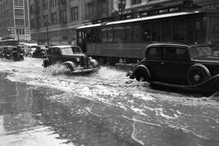
An El Nino can bring about 30 inches of rain to Orange County, nearly 70% more rain than usual. Reduce the risk of storm damage by taking some precautions:
* Clean rain gutters
* Stake small trees
* Tie down, or store, patio furniture
* Check weather-stripping around doors, windows
* Fill in low spots in yard where flooding may occur
* Prepare emergency kit with first aid supplies, bottled water, canned goods, radio and extra batteries
* Store flashlights in kitchen, individual bedrooms
* If home is on the beach, replace lost sand whenever possible
* Clear yard of objects that a wave might dislodge, including even heavy decorative logs.
* Prepare sandbags, available at both county and city fire stations.
Places of Concern
Rain and waves associated with El Nino are expected to pound the county shoreline harder, while higher sea levels threaten to carry waves farther on shore, posing a threat to seaside businesses and possibly flooding homes. Hazard scenarios around the county:
* Seal Beach shoreline erodes from heavy surf
* Sunset Beach homes flood from high tides, beach erosion
* Pacific Coast Highway floods along Bolsa Chica State Beach
* Trabuco and Silverado canyons flood from debris-choked streams
* Powerful waves, possibly as high as 20 feet, damage Newport and Balboa piers
* Heavy rains cause mudslides in San Clemente
* Beaches erode from south Laguna to San Clemente
Unusual Visitors
Game fish, seeking to escape overheated Mexican waters, follow El Nino up the coast of North America. The result: From Southern California to Canada, a longer fishing season with a more varied catch:
Yellowfin Tuna:
Catches reported as far north as the normally frigid waters of San Francisco Bay.
Mahi Mahi:
Swimming off Orange County’s shoreline all summer; still present in strong numbers.
Blue Marlin:
The first-ever catch of a blue marlin off Washington state was reported near Seattle this summer. Blue marlins are predominantly found off the coast of Mexico.
For More Information
Learn more about El Nino and monitor its movements at these web sites:
* https://www.cdc.noaa.gov/ENSO
* https://www.nwsla.noaa.gov/
* https://www.atmos.washington.edu/
* https://pfrd2/elnino/
Sources: Scripps Institute of Oceanography, National Oceanic and Atmospheric Administration, Tropical Ocean Global Atmosphere Program, Western Regional Climate Center, SIO Climate Research Division, World Book Encyclopedia ; Researched by APRIL JACKSON and IAN BOTT / Los Angeles Times
More to Read
Sign up for Essential California
The most important California stories and recommendations in your inbox every morning.
You may occasionally receive promotional content from the Los Angeles Times.


